QGIS User Guide translation
I have finished translating the QGIS 1.8.0 User Guide into Russian. Online and PDF versions should be available tomorrow via links on the official website.
I have finished translating the QGIS 1.8.0 User Guide into Russian. Online and PDF versions should be available tomorrow via links on the official website.
Another of my modest contributions to QGIS is now in the master. I added 4 new tools to customise raster rendering: brightness and contrast controls (raster pipes, once you understand how they work, are cool and flexible thing). In addition to changing the raster rendering on the fly, users can also save the modified image for future use.
15.12.2012 14:11 · GIS · qgis, processing, howto
TauDEM (Terrain Analysis Using Digital Elevation Models) is a set of Digital Elevation Model (DEM) tools for extracting and analysing hydrological information from the topography represented by a DEM. It was developed at Utah State University (USU) for hydrological analysis of digital elevation models and watershed delineation.
TauDEM has recently been integrated into QGIS as a SEXTANTE provider. This makes it possible to run TauDEM tools directly from QGIS, easily perform complex analysis workflows, and view the generated results.
In this post, I will show how to perform some hydrological analysis tasks in QGIS using TauDEM, namely how to delineate watersheds and extract stream networks.
Read more ››About a week ago, Alessandro Furieri announced the release of SpatiaLite 4.0.0 — a spatial extension to SQLite. There are not just a lot of changes, there are VERY many of them. And some of them may cause compatibility problems, so all users should read the migration guide.
Among the most interesting features:
And yesterday, the SpatiaLite data provider in QGIS was updated. Compatibility with databases created in previous versions of SpatiaLite is maintained. However, you will need to convert your databases to the SpatiaLite 4.0.0 format (you can use spatialite_convert from spatialite-tools) to take full advantage of the new features.
27.11.2012 17:55 · GIS · qgis, processing, howto
SEXTANTE is a powerful and flexible platform for performing geospatial analysis in QGIS. It provides access to its own geoprocessing functions as well as algorithms implemented in third-party applications, making analysis easier and more productive.
Initially written in Java and only available to gvSIG users, SEXTANTE has gradually extended its presence to other GIS. In 2012, a Python version was developed for use with QGIS. It immediately attracted a lot of interest from users and developers alike, and in September 2012 SEXTANTE was integrated into QGIS as a core plugin.
SEXTANTE in QGIS allows you to use the main features of well-known third-party GIS tools (SAGA GIS, GRASS GIS, TauDEM, OrfeoToolBox…) and algorithms implemented directly in SEXTANTE (fTools, MMQGISX…) via a unified interface.
It also offers a wide range of possibilities for automating data processing: combining repetitive steps of applying algorithms to data in a custom analysis model, writing and using Python scripts, batch processing mode. Advanced users can further increase their productivity by using SEXTANTE algorithms and the Python console together.
Read more ››18.10.2012 16:41 · GIS, Notes · qgis, plugins
Two of my plugins are in the TOP-20 by downloads, 4 by ratings and 5 by votes. It’s a small thing, but it’s nice.
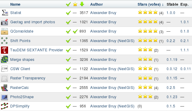
Actually, the list is not complete, as there are still C++ plugins that are distributed as source code and plugins that are not published in the official repository. And some plugins, although they have been significantly reworked by me and are now maintained by me, were originally created by others.
11.10.2012 08:33 · GIS · qgis, howto
As I wrote before, Oslandia kept their promise, and during the 8th QGIS developer meeting, the Atlas plugin was integrated into the QGIS print composer. This has been made possible thanks to the financial support (although not the full amount has been raised) of the following individuals and organisations:
The workflow remains the same: create a print layout and specify a coverage layer that will be used to generate the atlas. In addition, it is now possible to create complex labels using the full power of QgsExpression and the attributes of the coverage layer.
Let’s go through the process of making an atlas step by step.
Read more ››07.10.2012 17:52 · Notes · qgis, meetings
The 8th QGIS developer meeting, also known as the hackfest, has come to an end.
This time there were no presentations, which had been a feature of the previous two meetings, and this had a positive impact on the results: more than 120 commits were made, and about 60 bug reports were closed. Among the most notable changes:
On top of that:
According to the participants, this meeting was one of the most productive, which was greatly facilitated by the venue — Villa Vogelsang.
06.10.2012 14:09 · GIS · qgis, plugins
QGIS plugin developers should note that it was decided at the hackfest to make changes to the plugin metadata. Namely:
author fieldemail fieldauthorName field is declared deprecated and is ignored when parsing metadataThe new fields must be present in both the __init__.py file and the metadata.txt file. The purpose of this change is to separate the actual author of the plugin from the plugin maintainer. For plugins already uploaded to the repository, these metadata fields will be filled in automatically using information from LDAP, but for all new plugins, these fields should be set by the developer.
The changes are effective as of today.
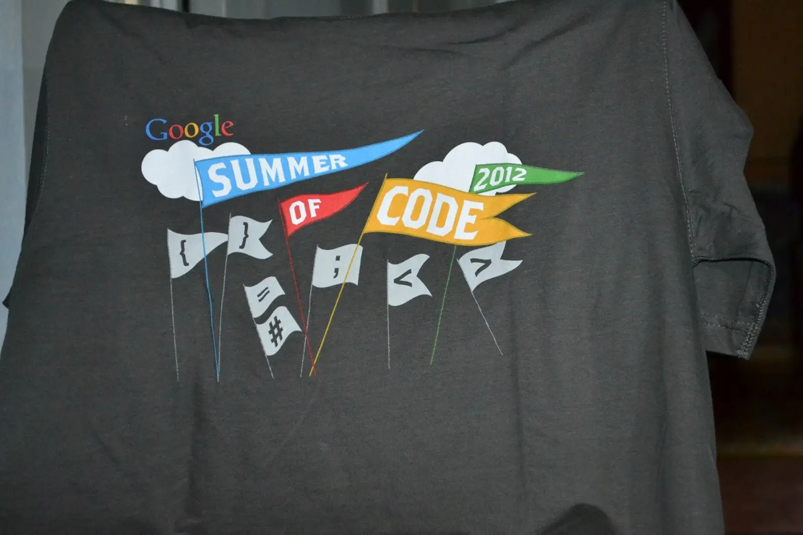
04.10.2012 09:42 · Notes · qgis, gsoc
Morning. I’m working in the office when the silence is broken by a ringing telephone. A call from an unknown number. I answer. A man asks if it’s me, and when I say yes, he continues, “It’s FedEx bothering you”. O_o. “Your package has arrived. Should we deliver it to your place, or will you pick it up from our office? My eyes started to twitch. What package? From where? I asked for more details. Hm… they seem to be correct, but that didn’t make things any clearer.
In about 30 minutes, the package was on my desk. I checked the return address and didn’t understand anything. It was only when I took out the contents that it all made sense. There was this T-shirt