Raster Transparency
Raster transparency provides an interactive way to adjust transparent pixel ranges for singleband rasters or multiband rasters rendered in singleband modes. With the help of dual-handle slider it is possible to independently control the transparency at both minimum and maximum pixel values boundaries.
Installation
The plugin is available via my repository.
To install it, please follow these steps (for more details, see the QGIS User Guide):
- Start QGIS.
- Go to Plugins → Manage and Install Plugins….
- Go to the Settings tab and click Add… to add a new repository.
- Enter repository name, e.g. “Alex Bruy’s plugins”.
- Enter the repository URL https://plugins.bruy.me/plugins.xml.
- Click OK to close the Repository details dialog.
- Go to the All tab.
- Search for Raster transparency, select the plugin in the list and click Install Plugin.
Usage
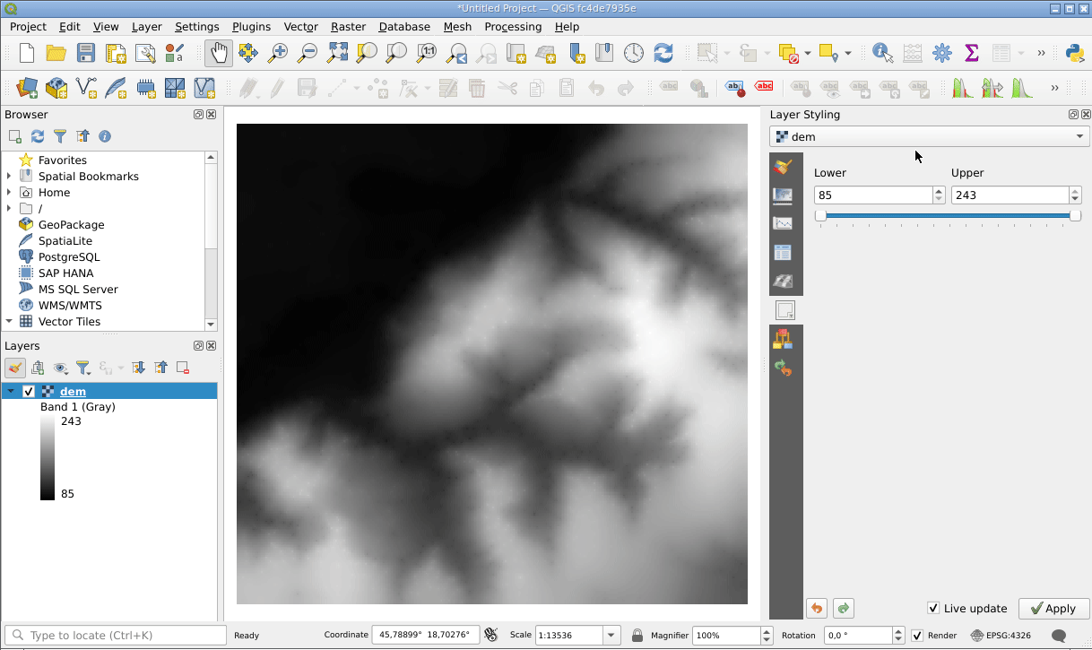
Once installed and enabled, Raster Transparency plugin adds a new tab called “Raster transparency” to the QGIS “Layer Styling” panel.
In the QGIS layer tree select a singleband raster or a multiband raster rendered in a singleband rendering mode (e.g., “Singleband pseudocolor”). Then, open the “Layer Styling” panel and switch to the “Raster transparency” tab.
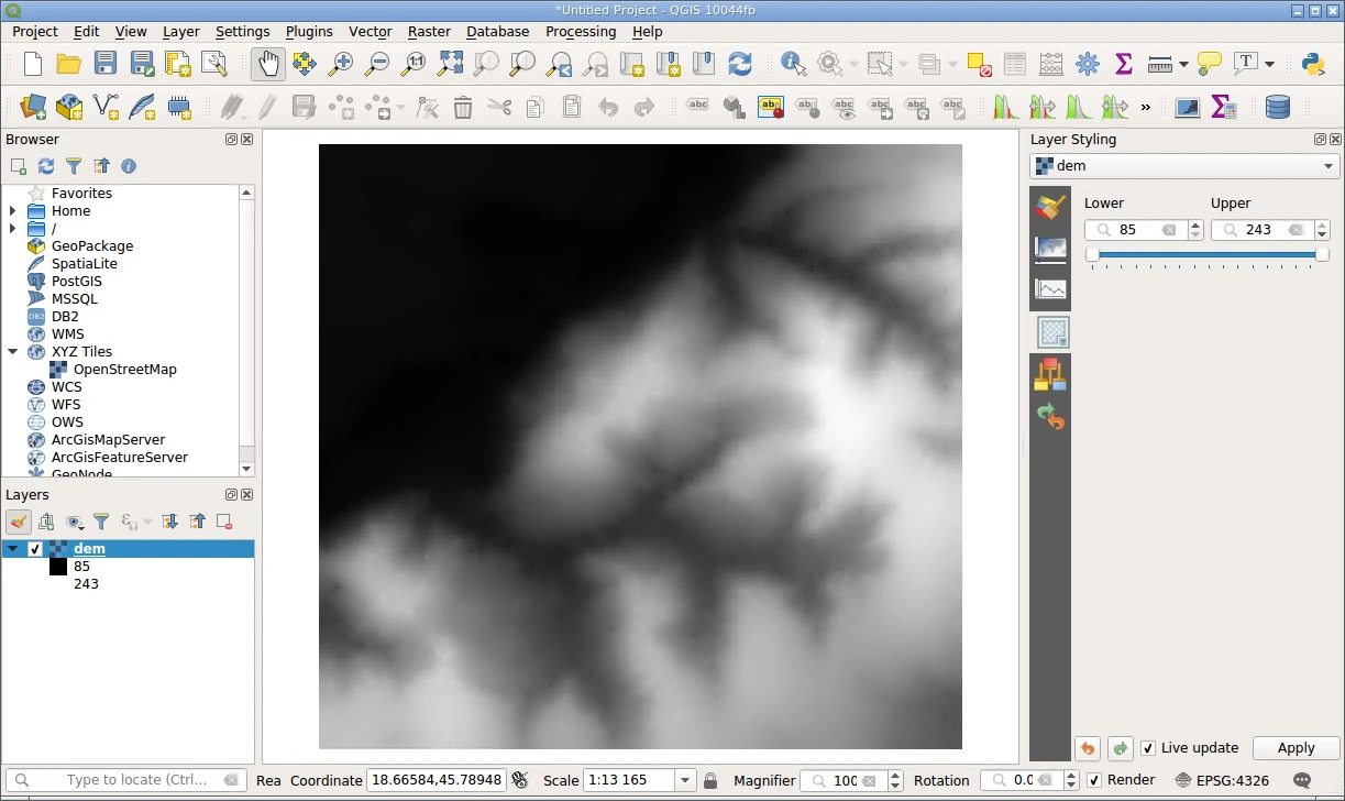
Use the slider and/or spinboxes to control the transparent pixels range. The slider has two handles: the left handle is used to control transparency from the raster’s minimum value to the upper pixel values; the right handle is used to control transparency range from the raster’s maximum value to lower pixel values. The raster transparency updates interactively as you move the slider handles or adjust the values in the spinboxes.
Defined transparent pixel range(s) will be added to the layer style and can be reviewed in the “Transparency” tab of the layer properties dialog.
For example, let’s look at a singleband raster layer with pixel values in the range from 85 to 243. After setting the left handle to the position 95, all pixels with values from 85 to 95 will become transparent. If we, additionally, move the right handle to the 220 position, a new transparency range will be added to the raster’s style, and all pixels with the pixel values from 220 to 243 will become transparent as well.
Reporting bugs
Please report bugs and submit feature requests via bugtracker.