Raster creation options in QGIS
As you probably know, QGIS support for raster data (both reading and writing) is based on the GDAL library. One of the essential parts of raster handling is support for raster creation options — parameters that control specific details of the created file. For example, the GeoTIFF driver has options to control compression and whether the file should be tiled.
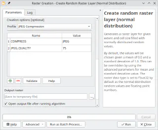
QGIS already allows setting these options when exporting raster dataset, GDAL algorithms in Processing of course, also support them. And not that long ago, I have implemented a corresponding widget wrapper for Processing and updated most of the native raster algorithms to support raster creation options out of the box.

However, there are more places in QGIS that could benefit from the creation options support, and I have recently started working in this direction. First, as a part of the QGIS bugfixing efforts, I updated the grid writer class used by QGIS’s native interpolation code to use the QgsRasterFileWriter API instead of writing output in the ASCII Grid format. This change not only allowed interpolation results to be saved in any GDAL-supported format but also paved the way for support for creation options and custom NODATA value.
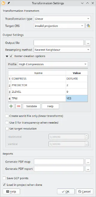
The next step was the georeferencer. While the original ticket, I was working on, was about support for the BIGTIFF option, I decided to implement a more comprehensive fix and added full support for creation options.

After that, now in my spare time, I continued to improve the support for creation options in various places in QGIS. With the QgsGridFileWriter using the proper API, it was not too hard to implement support for custom NODATA values and creation options. For now, this is still an API-only change, as the Processing algorithms using this class are written in Python and have some known issues. I would rather wait and expose new functionality when porting them to C++.
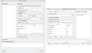
My latest contribution is related to the QGIS Raster Calculator. After adding API to set creation options and change the NODATA value, I have also exposed this functionality to the UI both in the native tool and Processing algorithm.

I hope all these changes will make your raster analysis workflows easier and more productive, and output files smaller and faster to load.
Do not hesitate to contact me if you have any suggestions related to raster creation options support in QGIS.