QGIS is 10 years old
Today, 19 July, Quantum GIS celebrates its 10th birthday. Over the years, QGIS has grown from a simple PostGIS data viewer developed by one person to a full-featured, extensible, cross-platform desktop GIS with support for multiple data formats, extensive analysis and design capabilities, which is developed by programmers from around the world and used successfully by individuals and organisations.
I suggest we remember how it all started.
Version 0.0.1-alpha (July 2002). Users can connect to PostGIS databases, view spatial tables, and add them to the map.
Version 0.0.3-alpha (10 August 2002). Added support for shapefiles and some other vector formats; a primitive list of layers to control their visibility.
Version 0.0.4-alpha (15 August 2002). Added layer properties dialogue, ability to change colour used for layer rendering, and initial support for layer removal.
Version 0.0.5-alpha (5 October 2002). Support for layer removal, ability to adjust line thickness, added “Zoom Out” navigation tool.
Version 0.0.6 (24 November 2002). Attribute table viewer, identification tool, remember window size and position.
Version 0.0.7 (November 30, 2002). Added ability to build QGIS without PostgreSQL support.
Version 0.0.8 (11 December 2002). Closing the layer properties dialogue without saving changes undoes the changes made in it.
Version 0.0.9 (25 January 2003). Initial support for projects, improvements to the build system.
Version 0.0.10 (13 May 2003). Fixes to project handling and build system.
Version 0.0.11 (10 June 2003). Initial plugin support, ability to remove database connections, bug fixes.
Version 0.0.12 (10 June 2003). The identify tool can identify multiple features at the same time, added ability to select features in shapefiles using a selection rectangle, various bug fixes.
Version 0.0.13 (8 December 2003). Build system now uses autotools, permanent selection (for shapefiles only), ability to change layer rendering order by dragging and dropping layers in the list, export map to MapServer map file.
Version 0.1 “Moroz” (25 February 2004). Added support for GDAL rasters, transition to the “data providers” approach, plugin manager, three renderers for vector data, Buffer plugin for PostGIS layers.
Version 0.2 “Pumpkin” (26 April 2004). Ability to export map as image, view raster metadata, save plugin state between sessions.
Version 0.3 “Madison” (28 May 2004). It is possible to create pyramids (overviews) for rasters, display of map scale and cursor coordinates, new Copyright and North Arrow plugins, possibility to set map units.
Version 0.4 “Baby” (4 July 2004). Added overview map, initial printing support, icon theme support, scale bar plugin, started work on the Windows build.
Version 0.5 “Bandit” (5 October 2004). Windows version, feature labelling, ability to set filter query when opening PostGIS layer, support for digitising via GRASS, “unique values” renderer.
Version 0.6 “Simon” (19 December 2004). GEOS support in the OGR provider, editing support for PostGIS layers, scale-dependent rendering, actions, ability to create new shapefiles, query builder for PostGIS, new plugins.
Version 0.7 “Seamus” (2 July 2005). Added support for projections.
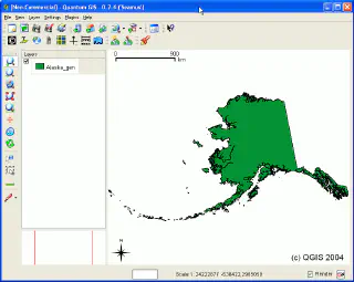
Version 0.8 “Joesephine” (7 January 2007). Migration to Qt4 has started.
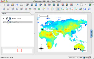
Version 0.8.1 “Titan” (June 15, 2007). Editing of vector layers, OGC WMS support, copy/paste vector features, search by attributes, area measurement, migration to Qt4 completed.
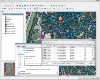
Version 0.9 “Ganymede” (26 October 2007). Changed build system (now using CMake), improvements to the raster georeferencing plugin, Python API, improvements to print composer.
Version 0.9.1 “Ganymede” (January 6, 2008). Ability to select UI language, Plugin Installer for downloading Python plugins, bug fixes.
Version 0.10.0 “Io” (3 May 2008). Introduced .qml files — files describing the style of vector layers, support for transparency and contrast enhancement for rasters, improvements to digitising tools, icon updates.
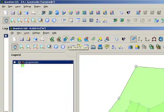
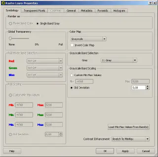
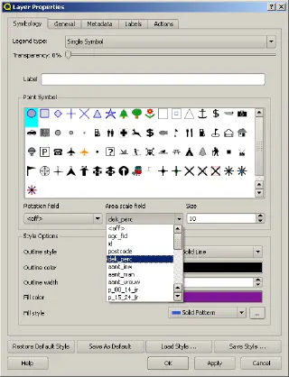
Version 0.11.0 “Metis” (21 July 2008). Support for .qml for raster layers and layers from databases, updated dialogs, symbol preview in vector layer renderers, search for plugins in the Plugin Installer and for GRASS modules in the corresponding dialogue.
Version 1.0.0 “Kore” (5 January 2009). API stabilisation, topological editing of vector data, HIG support on all platforms, export of selected features to file, new core plugins.
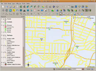
Version 1.0.1 “Kore” (16 February 2009). Bugfixes. The first attempt to support two branches, “stable” and “development”.
Version 1.0.2 “Kore” (23 April 2009). Bugfixes.
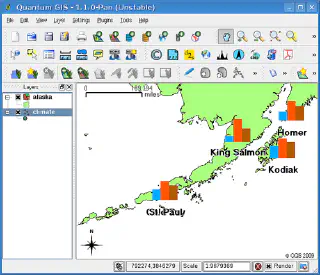
Version 1.1.0 “Pan” (12 May 2009). New “Add vector layer” dialogue, diagram overlay, fTools plugin included in core, improved print composer and attribute table.
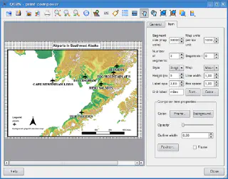
Version 1.2.0 “Daphnis” (1 September 2009). Major improvements to the digitising tools, several new digitising tools added (delete part, simplify feature, node editing tool), support for undo/redo digitising, added OSM data provider and plugin, added eVis and Interpolation plugins, a new GRASS console, support for relative paths in the project, SSL support in the PostgreSQL data provider.
Version 1.3.0 “Mimas” (20 September 2009). Improvements in OSM plugin (new style, reworked dialogues and other improvements), possibility to choose a primary key for the views, variable size of vertex markers, top-to-bottom mode for Identify tool, Raster terrain analysis plugin.
Version 1.4.0 “Enceladus” (10 January 2010). New symbology, field calculator, grid overlay in print composer, ability to work with multiple maps in a print composer, support for drawing arrows and shapes in the print composer, added renderer cache to speed up rendering, support for custom attribute forms, UI improvements.
Version 1.5.0 “Tethys” (29 July 2010). Measure angle tool, attribute tables can be inserted in print composer, Python console, rule-based renderer for new symbology, annotations (text and dialogue), Spatial Query plugin, SpatiaLite support.
Version 1.6.0 “Copiapó” (27 November 2010). “Offline editing” plugin, gpsd support, built-in raster calculator, WFS-T support, QGIS MapServer, support for geometryless tables.
Version 1.7.0 “Wrocław” (19 June 2011). New symbology used by default, export and import styles, new tools in GDALTools and fTools, startup tips, on-the-fly raster reprojection, support for joined tables, display of a plugin icon in Plugin manager.
Version 1.7.1 “Wrocław” (30 September 2011). Bugfixes. A second attempt to maintain two branches, “stable” and “development”.
Version 1.7.2 “Wrocław” (21 November 2011). Bugfixes.
Version 1.7.3 “Wrocław” (15 December 2011). Bugfixes.
Version 1.7.4 “Wrocław” (21 February 2012). Bugfixes.
Version 1.8.0 “Lisboa” (21 June 2012). Predefined scales, embedding layers from another project, new CRS selector, message log for debug messages, interface customisation, QGIS browser, DBManager plugin, expression-based labelling, SLD style support, MSSQL spatial data provider, WFS support in QGIS Server.
If you are new to QGIS, you might want to try one of the earlier versions (e.g. QGIS 0.10.0 “Io”). And for the grumblers and the perpetually dissatisfied, I would suggest comparing it to the latest QGIS versions. Just to make sure it’s not that bad.
P.S. I remember QGIS 0.6.0, and which QGIS version did you start with?