GIS Geoproject vs competitors
02.12.2008 12:17 · Notes · geoproject
During my work in the field of cadastre I had the opportunity to use several different programs: Invent-Grad for DOS and Windows, Delta Digitals and GIS Geoproject 5.x. Some of them I used a lot, others less. I hope that my observations will help people make a choice.
All the following is based on my own personal experience and opinion — your mileage may vary.
Invent-Grad for Windows
For obvious reasons, we will not consider Invent-Grad for DOS, even though it is quite powerful. Invent-Grad for Windows is still popular and is used by many organisations. It has a graphical interface reminiscent of Windows 95/98.
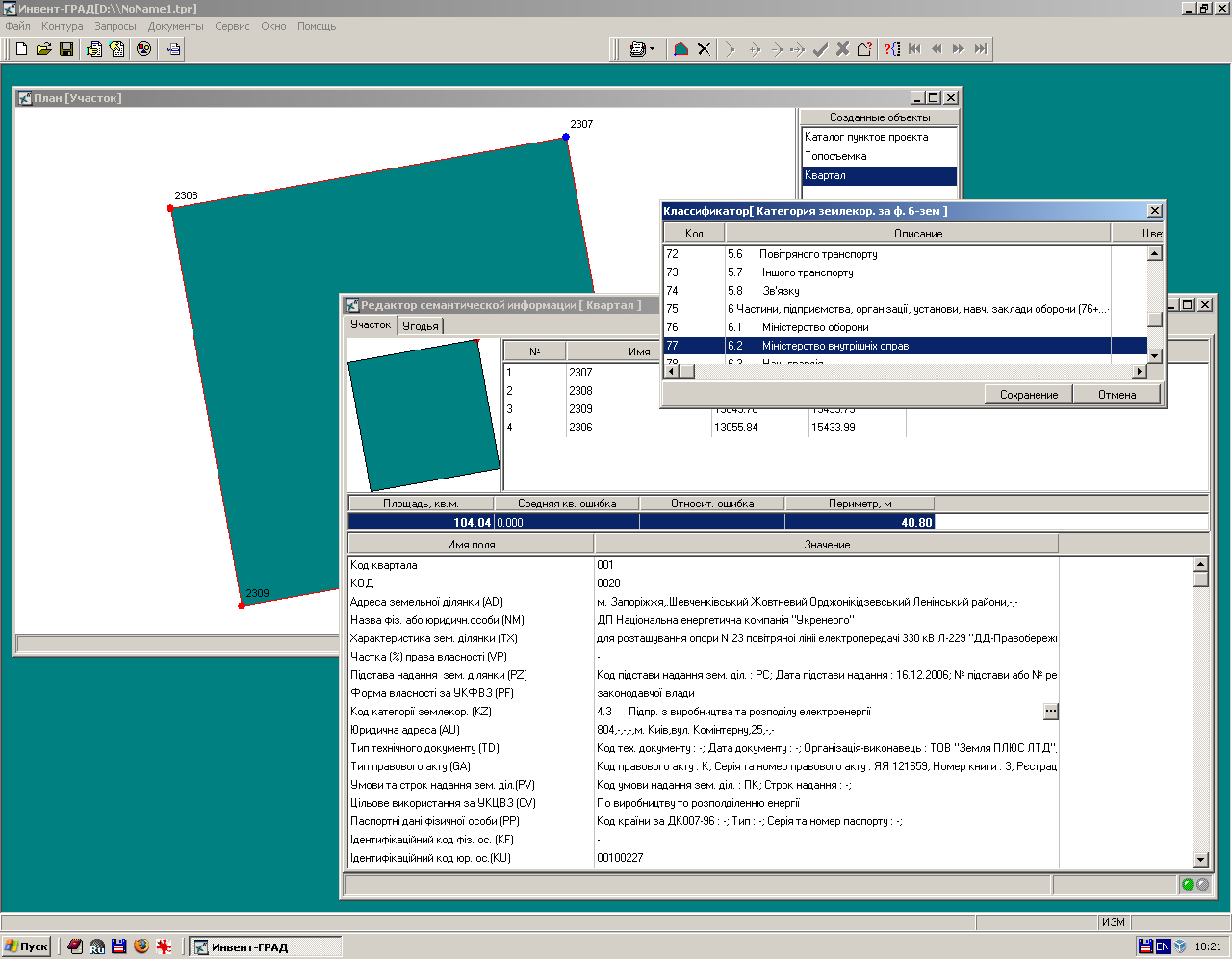
The interface is not very convenient: all the windows reside in the main programme window (MDI interface), so they constantly overlap, and to make matters worse, there are no hotkeys at all — all actions are performed with the mouse.
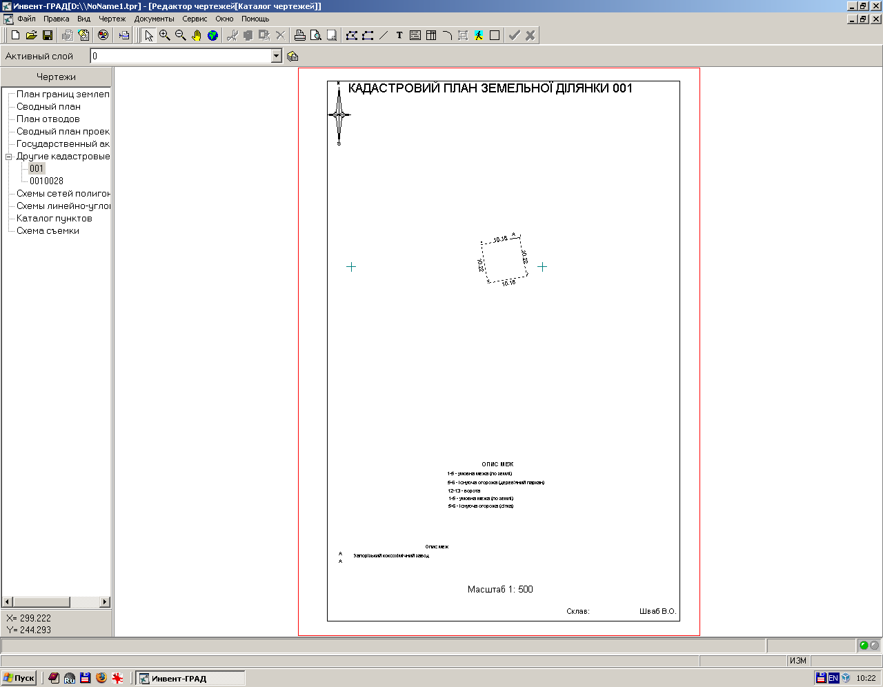
Invent-Grad allows you to carry out a wide range of tasks: from processing the results of topographic and geodetic work to creating an exchange file and producing various text and graphic documents.
The digitising process is quite convenient: if necessary, you can zoom in/out or pan to the desired location without interrupting the digitising. However, all these actions must be carried out using the mouse and the appropriate tools - as already mentioned, there are no hotkeys. However, if the object is quite complex and large, this approach makes sense: you can quickly pan to any location. When filling in the semantics, it is possible to select values from directories.
Invent-Grad allows you to customise the internal database, modify templates for the import/export of exchange files, and edit document templates. However, the lack of clear and complete documentation and the absence of any community make this task very non-trivial. Everything has to be learned by trial and error.
Unfortunately, there is no support for raster basemaps.
Documents are generated using its own report generator. It supports templates and can inject values from the semantic database into documents. There is a set of standard documents that can be used as a starting point for creating your own templates.
When importing exchange files, both semantic and spatial information is validated, and appropriate diagnostic messages are shown. If the contour contains vertices with the same names but different coordinates, you will see something incomprehensible on the map instead of a land plot polygon.

Similarly, if there are errors in the semantic block, it will be completely ignored.
The latest version is 2.007, development of the project has been stopped long ago, and new versions are not released.
Invent-Grad was sold on a per-seat basis, and a HASP hardware key was used for protection. The cost ranged from 1600 to 2600 UAH, depending on the configuration.
Delta Digitals
Delta Digitals is actively developed and promoted as a universal tool for all tasks, imaginable and unimaginable. It has a graphical interface in the classic Windows 95/98 style. Access to some operations is possible both with the mouse and with hotkeys.
It is a modular application: for each type of work there is a separate, independent programme, which makes it possible to control the cost and functionality of the complex to a certain extent.
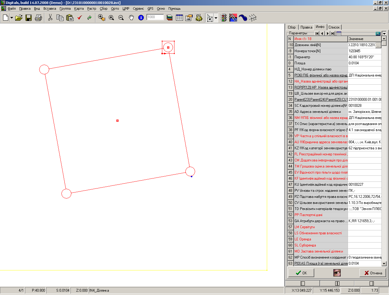
As far as I know, Digitals was not originally developed for cadastral tasks but was positioned as a tool for digitising photo-survey results and producing electronic topographic maps. Support for cadastral exchange files and the ability to create graphic and text documents were added much later.
Before you can perform any cadastral tasks in Digitals, you have to do a lot of preliminary work to configure the system because, after installation, there is no support for cadastral objects and their semantics in the programme. This has been addressed in recent versions, but the results are still far from perfect.
Filling in semantic information is implemented in an extremely uncomfortable way: the object properties panel is fixed in the right part of the main program window, the internal identifiers precede the names of the semantics; to fill in many descriptors it is necessary to open additional dialogues. However, this situation is expected: support for cadastre tasks and exchange files has not been considered in the development of Digitals. It is possible to create directories, but the information in directories is entered as a single line, making them hardly usable.
In recent versions, it seems possible to check the semantic information when opening and saving exchange files, but this isn’t available in the demo version, so I wasn’t able to test it in a real-world test, which is a shame.
However, files with errors in the spatial descriptors (overlapping vertices, the presence of vertices with different names but the same coordinates, etc.) are processed by Digitals without any warnings. Apparently, when creating polygons, it assigns internal numbers to vertices and does not use data from the exchange file. And this is another place where you need to be extra careful.
Raster basemaps are supported, and recent versions have added support for the GoogleMaps service (which allows you to download satellite imagery to a local machine and use it as a basemap). The question is how this complies with the GoogleMaps terms of service.
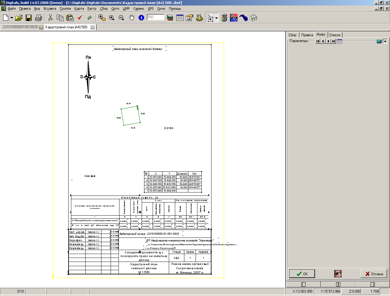
There is a report generator based on FastReport 2.5. However, its documentation is very poor and does not cover the interaction between the report generator and the main program. Furthermore, the report generator can only create text documents. To create graphical documents (cadastral plan, state act, plot plan, etc.), predefined Digitals projects are used. You must insert your objects into this project and then print it.

In general, Digitals gives a mixed impression: on the one hand, when you work with it, you realise that it has a lot of features. On the other hand, the lack of documentation, the separation of documents into graphics and text, the many workarounds and shortcomings in support for exchange files, and the cumbersome interface leave a feeling of incompleteness and do not inspire one to study the programme.
The programme is under active development and has quite a large community. The pricing policy is quite acceptable (the cost of a copy depends on the configuration and varies from 900 to 1800 UAH, there are various discounts), but the maximum number of copies working with one key is limited to 5. There is no corporate licence as such. A hardware key is used for protection (either a separate key for each machine, or a network key for 5 machines).
GIS Geoproject 5.х
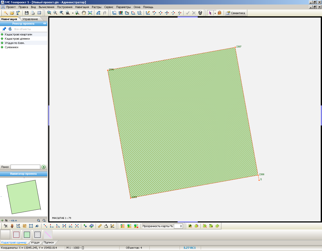
GIS Geoproject 5.x is the “youngest” of these three programmes. It has a pleasant, modern interface and has been developed with cadastral and geodetic tasks in mind.
The programme is based on the principle that “everything can be customised”. The user can modify both the import/export data templates and the system script, which is a kind of settings database, as well as the document templates. If you are missing a feature, the documented API for writing plugins is at your service.
Geoproject has a module for performing geodetic calculations and also supports raster basemaps. It is very convenient to fill semantics: there is support for default values, numerous directories are available and users can add their own, semantics themselves can be grouped by purpose, and groups can be minimised and maximised.

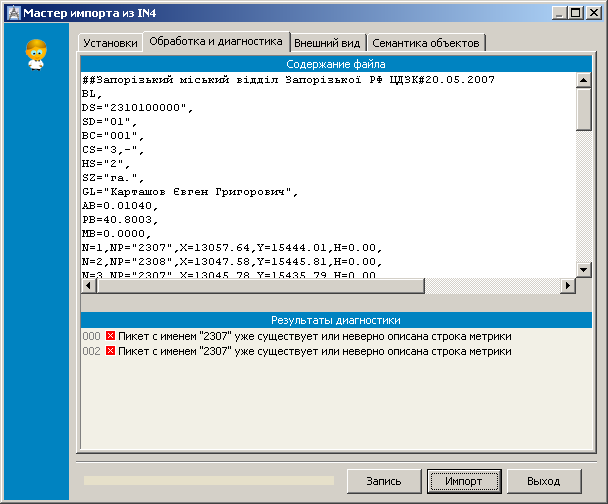
When importing Exchange files, they are validated and if errors are found, the appropriate diagnostic messages are displayed with the number of the line where the error occurred. Errors in the spatial descriptors are handled, but unlike Invent-Grad, their presence does not affect the correctness of the resulting polygon. You should be careful here.
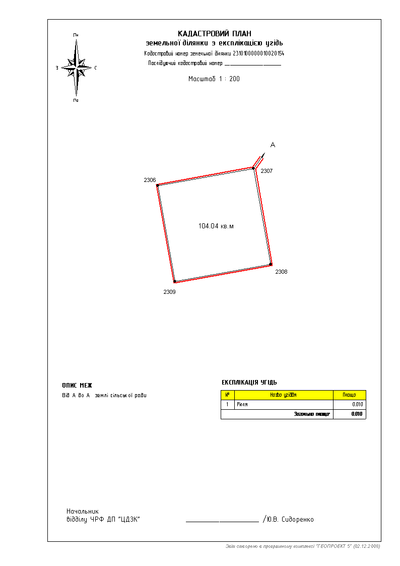
Geoproject uses the latest version of FastReport 4.5 as its report engine. It is updated with each new release of the programme. The standard installation comes with a fairly large set of templates. Templates can contain both text and graphical information, and there is the possibility to interact with external databases.
The programme is under very active development and the author is paying attention to the users’s requests. You can always get help and find a solution to a problem on the support forum. The community is not as large as in Digital, but this does not affect the quality and efficiency of the support.
Geoproject has the most liberal pricing policy: one copy for 800 UAH; a corporate licence is available for organisations, allowing an unlimited number of installations within the organisation at a rather affordable price of 3100 UAH. An activation code is used for protection.
Update from 13.03.2018
As far as I know, Invent-Grad is not currently in use anywhere. This is mainly due to the lack of support for the new exchange file format based on XML.
In 2012 the development of GIS Geoproject was stopped, the latest version, 5.29, is distributed as freeware.